
blah blah blah
The Rocks Estate
Length: 0.8 mile loopDifficulty (click for info): Beginner
Elevation Gain: 50 feet
Rating (click for info): 5/10
Driving Directions:
Trailhead and parking area are on Glessner Road in Bethlehem, NH. This is on the south side of Rt. 302 0.3 miles east of Rt. 18 at exit 40 off I-93 or 2.4 miles west of Rt. 142 in the center of Bethlehem. Drive 0.2 miles up the entrance road, then bear right away from Christmas Lane and immediately turn left beside the barn and park in the large lot behind. Click here for a Google map.
Trail map
About the Hike:
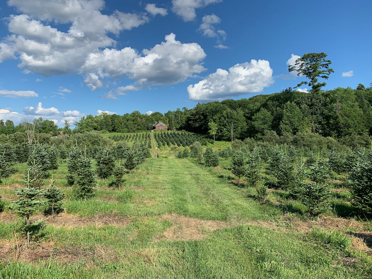
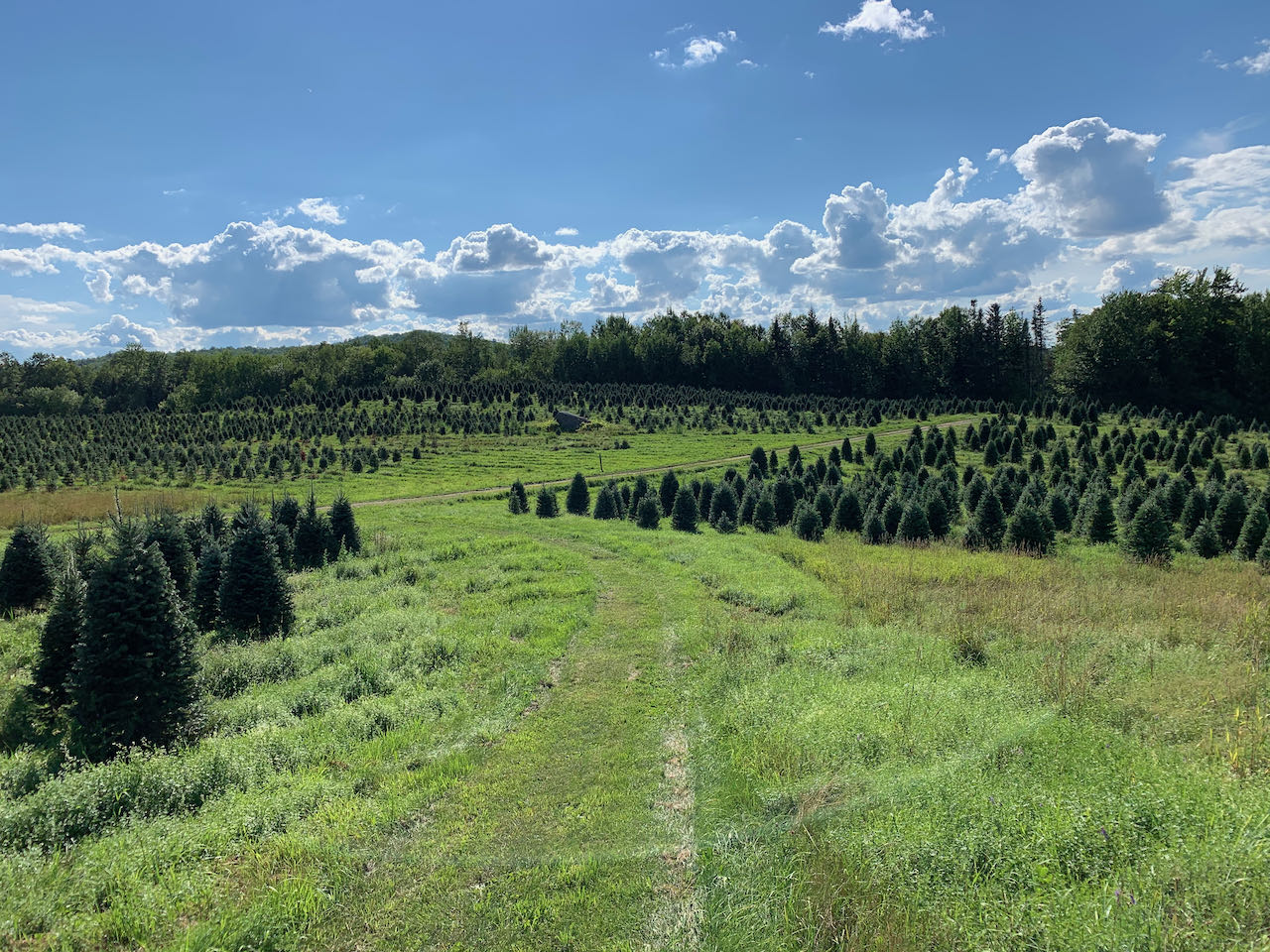
The beloved historical Christmas tree farm, The Rocks Estate (recently revitalized and rebranded as "The Rocks") has been serving its seasonal tradition for over 60 years. The land began its life in public prominence in the 1880's when it was purchsed by John Glessner to double as his family's private summer estate, including 19-room mansion, and conservation land to protect an area from the widespread farming happening at the time. In the 1970's, many of the residential structures were torn down and the land was donated by the family to the the Forest Society, which has operated it as a tree farm ever since to fulfill the terms of the donation. Today, it is open to the public to experience its fascinating history. Take note that this trail through the tree farm is open ONLY ON WEEKENDS for most of the year (Apr 1 - Nov 17), as care of the trees is taking place during the week. Several walking trails tour the property to guide visitors through its various features. The walk we describe here will take you through the tree plantation itself to learn about the process (with informational stops) of farming Christmas trees.
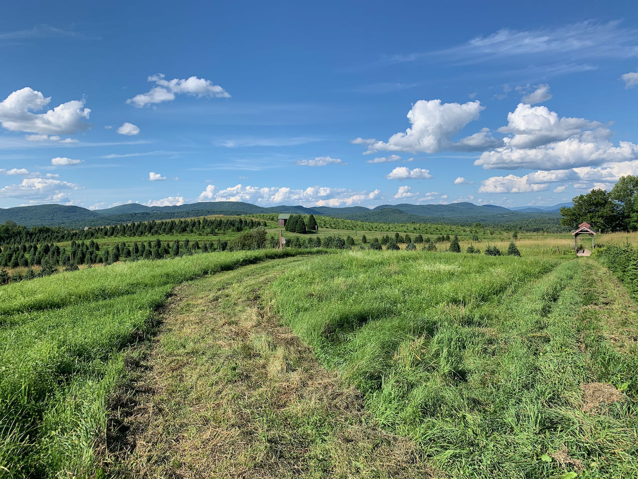
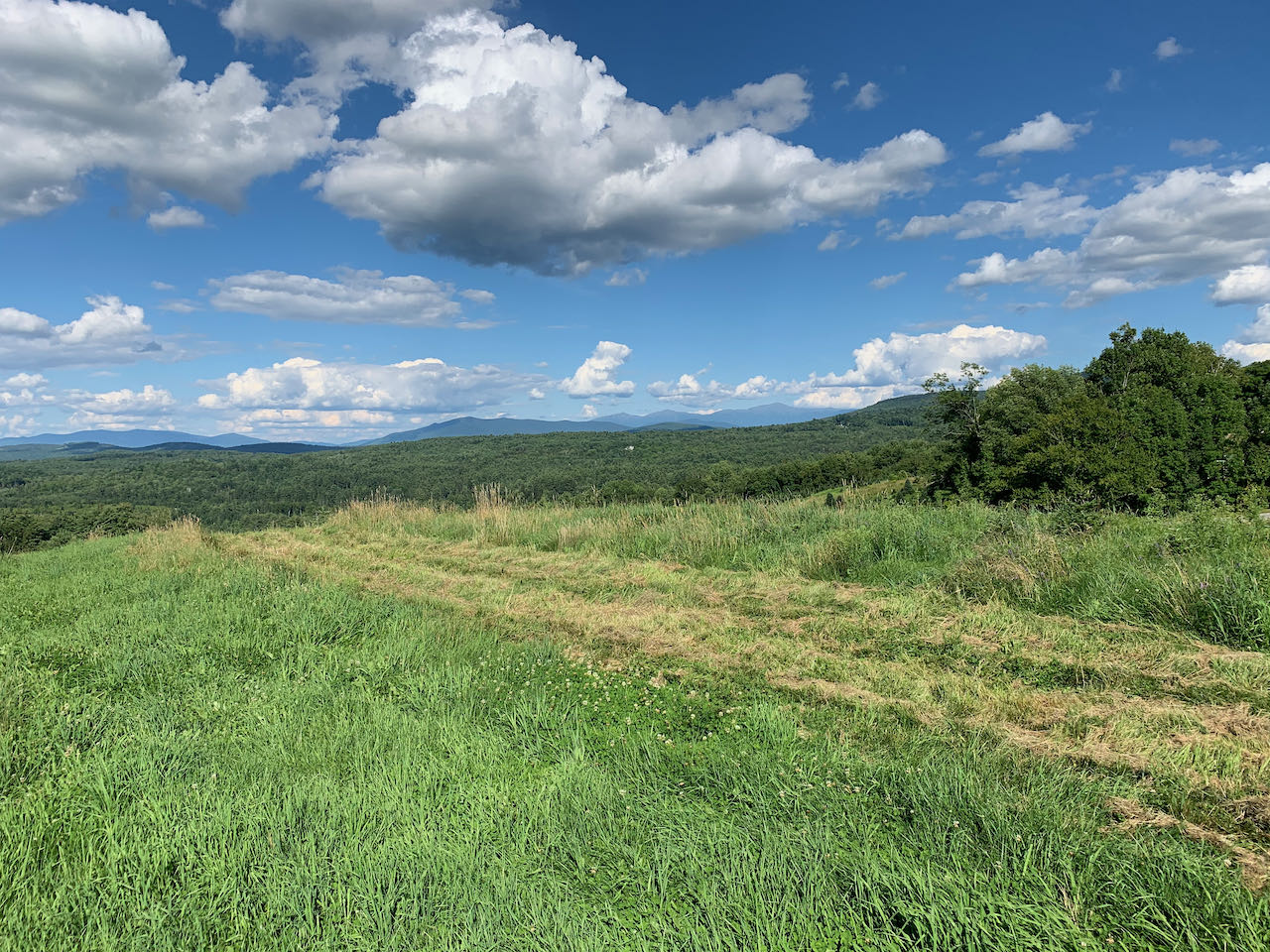
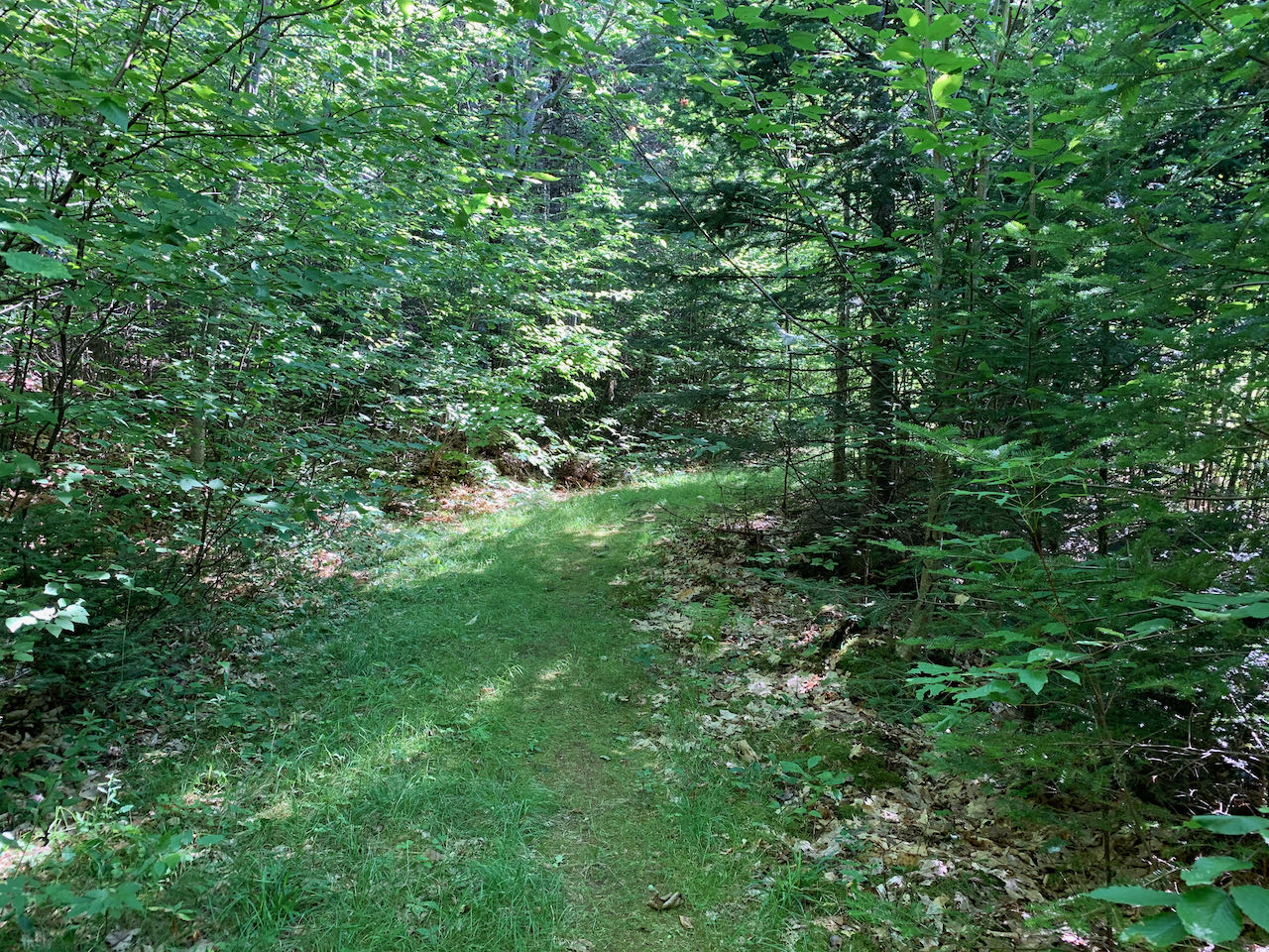
From the parking area behind the barn, walk west around the corner of the building toward the tree plantation. Cross the dirt road and enter the field through the granite posts, then follow the mowed path downhill through the decorative bridge. Turn left at the dirt tractor road, then veer right onto the grass and walk past an entrance sign to the top of a knoll, where there are sweeping mountain views, stretching from the low hills of the Dalton Range on the left, across past Mts. Agassiz and Cleveland to the distant Pilot and Pliny Ranges, and the northern Presidentials behind the Cherry-Dartmouth Range all the way on the right. Continue along the mowed path down from the knoll and back to the tractor road. Walk the dirt road through a stonewall and just outside the plantation. Turn left onto an older road at an easy-to-miss arrow sign. Stroll through the woods for a bit, then turn left off the road at another arrow sign and take a wooden bridge back over the stone wall. Continue following the grassy path as it swings to the left, then returns to the barn on a long straightaway through neat rows of trees.
Printable directions page